Aerial imagery is used for a wide range of tasks within the context of AutoCAD Map 3D and AutoCAD Civil 3D. Although some image formats such as Mr. SID provide highly compressed, high-resolution imagery within the context of these products, these images only cover but so much area. This can be especially challenging if your site is on the line of two adjacent municipalities (otherwise known as the extent of such imagery).
Autodesk Labs recently introduced an incredible tool that brings an almost endless canvas of aerial imagery directly to AutoCAD Map 3D 2013 and AutoCAD Civil 3D 2013. Project Basejump is a free technology preview that allows you to access Micosoft Bing Web Mapping Services (WMS) without leaving AutoCAD. This allows you to add dynamic resolution aerial imagery and/or road information as a common Data Connection.
After downloading and installing Project Basejump, you can add imagery by:
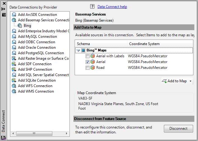
- Click Connect from the Data panel of the Home Ribbon tab within the Planning and Analysis (Map 3D) workspace.
- Select the Basemap Connection Services Data Connection, Provide a name, and finally choose the data you want to add before clicking "Add To Map" to finish the connection.

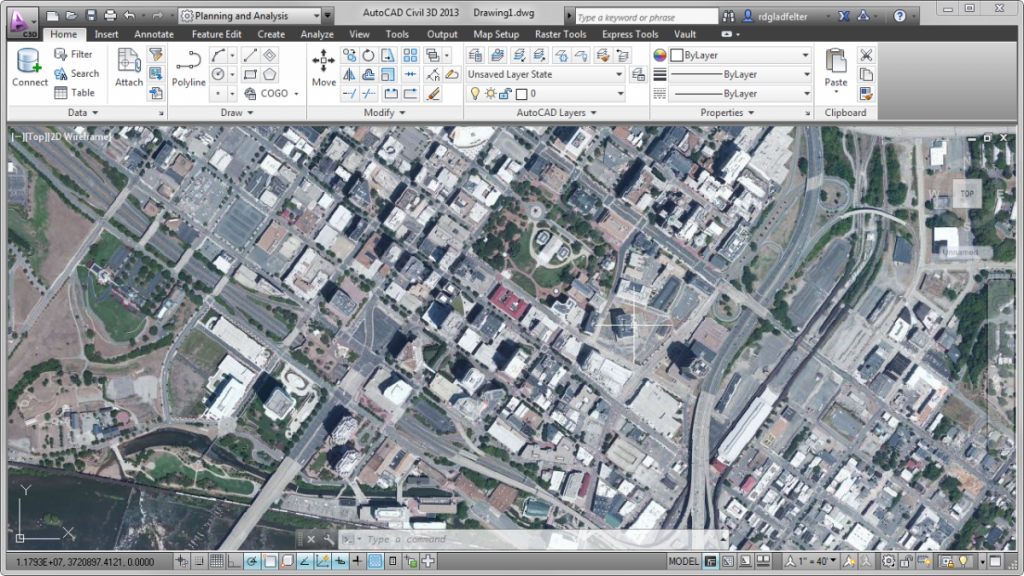
After completing the connection, the data you selected will be added to the drawing window. The image above is a picture of our newest office in Richmond, VA, and illustrates the level of detail you can expect from this tool.
This data behaves just like any other GIS information you might add to your drawing from the same Data Connect palette. In fact, you can overlay such GIS information with that method, or perhaps even AutoCAD line-work for a proposed site atop this data from Bing if you wish.
To add this functionality to your existing installation of AutoCAD Map 3D 2013, or AutoCAD Civil 3D 2013, browse over to the Autodesk Labs Project Basejump page to download this technology preview. The current Autodesk Labs project will operate until August 12, 2013.